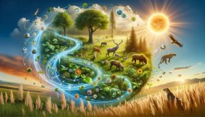
Did you know that nearly 70% of our planet’s surface is covered by water, yet much of its ecological secrets remain hidden from our view? Remote sensing in ecology acts as nature’s watchful eye, using satellite and aerial imagery to monitor environmental changes and wildlife health from above. This innovative technology not only enhances our understanding of ecological dynamics but also equips us to make informed decisions for conservation efforts. As we face the pressing challenges of climate change, habitat loss, and biodiversity decline, embracing remote sensing opens pathways to protect our planet more effectively. By understanding how these tools work, you can engage in the conversation around sustainable practices and support solutions that make a real difference. Dive deeper with us into how this fascinating field is reshaping our relationship with nature and paving the way for a healthier, more sustainable world.
Understanding Remote Sensing: A Key to Ecological Insights
Understanding the intricate relationships within ecosystems is paramount for effective conservation efforts, and remote sensing technology offers a unique window into these environments. Utilizing remote sensing not only provides invaluable data but also enables researchers to observe changes in ecosystems over time-something that is crucial for understanding biodiversity and assessing ecological health. For instance, satellite imagery can track deforestation rates, monitor the health of coral reefs, and help manage wildlife populations by revealing their habitats’ conditions from a macro perspective.
With the ability to capture information across vast areas, remote sensing technologies such as satellite imaging, LiDAR, and aerial drones have transformed ecological studies. These tools facilitate a wealth of applications; from assessing land use changes to mapping wetlands, they offer researchers an expansive view that ground surveys cannot match. For example, researchers can analyze variations in vegetation cover which directly correlate to animal habitats and migration patterns, allowing for more targeted conservation strategies.
Moreover, the advancement of data processing techniques, such as machine learning and artificial intelligence, enhances the quality of insights derived from remote sensing. By integrating datasets from different sources, scientists can create more detailed models of ecological dynamics. This multidimensional approach leads to better decision-making in conservation planning and reinforces our understanding of the profound impacts of climate change on biodiversity. As we delve deeper into the possibilities that remote sensing offers, it is clear that adopting these technologies can significantly boost our efforts toward achieving sustainable environmental management and promoting ecological resilience.
In this age of rapid environmental change, embracing remote sensing not only aids scientific inquiry but empowers individuals and communities to take informed actions to protect our planet’s rich natural heritage. By staying informed about these technologies and their applications, we can all contribute to a more sustainable future.
How Remote Sensing Works: Technology Behind the Scenes

The intricate mechanisms of remote sensing may seem complex, but they are guided by fundamental principles that allow us to observe and analyze the natural world from great distances. At its core, remote sensing involves capturing data about Earth’s surfaces without making direct contact. This is accomplished through various technologies, such as satellite imagery, aerial photography, and LiDAR (Light Detection and Ranging). These tools harness the power of electromagnetic radiation emitted or reflected from objects, translating that data into meaningful images and metrics about landscapes, ecosystems, and wildlife.
Understanding the Technology
The process begins when sensors onboard satellites or drones collect light reflected from the Earth’s surface. This light can include different wavelengths-from visible to infrared-and each wavelength can provide unique insights. For example, plants reflect more infrared light, which makes it possible to assess vegetation health and biomass. Once the data is collected, it undergoes processing through software that analyzes patterns, identifies changes over time, and reveals the underlying ecological status of different regions.
Modern advancements, such as machine learning and artificial intelligence, further enhance remote sensing capabilities. By integrating vast datasets, including historical imagery and ground-based observations, scientists can develop predictive models that forecast ecological shifts. This ability to synthesize and interpret large volumes of data allows for quick, informed decisions regarding environmental management and conservation strategies.
Applications in Ecological Research
The implications of these technologies extend beyond mere observation. Researchers utilize remote sensing to monitor wildlife habitats, track deforestation rates, and assess climate impact on biodiversity. For instance, by observing land cover changes through satellite imagery, ecologists can identify habitat fragmentation that threatens species survival and group migration patterns.
Additionally, the precision provided by remote sensing facilitates targeted conservation efforts. Decision-makers can pinpoint areas in need of protection, restoration, or sustainable management, fostering a more effective allocation of resources. As we adopt these cutting-edge technologies, we not only amplify our understanding of ecological dynamics but also empower communities to engage actively in protecting their natural environment.
In embracing remote sensing, we enable ourselves to transform complex ecological data into practical insights, fueling efforts for a sustainable future. By leveraging these tools, individuals and organizations alike can engage more fully in the stewardship of the planet, promoting a healthier, more resilient Earth for future generations.
Applications of Remote Sensing in Wildlife Conservation
The application of remote sensing in wildlife conservation is revolutionizing how we protect and manage ecosystems and their inhabitants. By enabling scientists and conservationists to gather vast amounts of data from above, remote sensing provides unparalleled insights into the behaviors, habits, and habitats of various species. For example, satellite imagery and drone technology are increasingly used to monitor changes in land cover and vegetation health, which are critical indicators of wildlife habitat quality.
One significant application of remote sensing in wildlife conservation is habitat monitoring. With high-resolution satellite images, researchers can assess changes in habitat over time, such as deforestation, urban encroachment, or natural disasters. This data allows conservationists to respond more effectively by prioritizing areas that require immediate attention, thus facilitating timely interventions. Furthermore, remote sensing can detect subtle changes in vegetation that may signal stress in the ecosystem, helping to identify potential threats to wildlife before they become critical.
Additionally, remote sensing technology is instrumental in tracking animal populations and movements. Using thermal imaging and radio telemetry, ecologists can remotely gather data on species distribution and behavior patterns without the need for intrusive methods that can disrupt wildlife. For instance, thermal cameras enable researchers to monitor nocturnal species or those in dense foliage, providing insights into their daily activities and survival strategies. This information is pivotal in formulating effective conservation strategies that cater to the specific needs of endangered species.
Moreover, remote sensing supports anti-poaching efforts by identifying illegal activity across vast landscapes. Sar satellite data can reveal changes in terrain caused by poaching activities, such as newly formed paths or the immediate aftermath of an event. By integrating remote sensing data with ground-level reports, organizations can deploy resources more effectively to combat poaching, ensuring that wildlife protection measures are both strategic and impactful.
In embracing remote sensing, we not only enhance our understanding of wildlife but also empower communities and stakeholders to take active roles in conservation efforts. The insights gained from these technologies fuel advocacy and educational campaigns, inspiring more people to engage with and support sustainability initiatives. By harnessing the power of remote sensing, the future of wildlife conservation looks brighter and more connected, offering new hope for both fauna and flora across the globe.
Harnessing Remote Sensing for Forest Management

The integration of remote sensing into forest management is revolutionizing traditional practices, allowing for more sustainable, efficient, and informed decision-making about our vital forests. By utilizing technology like satellite imagery, aerial drones, and specialized sensors, forest managers can gather extensive data without the need for extensive physical labor, which often disrupts ecosystems. This technological advancement enables a comprehensive overview of forest health, distribution, and changes over time, providing a powerful tool in the fight against deforestation and biodiversity loss.
Monitoring Forest Health
Remote sensing technology plays a crucial role in the ongoing monitoring of forest health. High-resolution satellite images can reveal changes in canopy cover, indicating areas suffering from disease, pest infestations, or environmental stress. With multi-spectral imaging, managers can assess vegetation indices that reflect plant vigor, enabling proactive management strategies. For instance, the Normalized Difference Vegetation Index (NDVI) helps determine plant health by comparing the amount of light vegetation reflects in various wavelengths-information essential for timely interventions before deterioration occurs.
Assessing Biodiversity
Another vital application is biodiversity assessment. Forest managers can use remote sensing to map and monitor different habitat types, ensuring that the unique ecological characteristics of various forest zones are preserved. By analyzing spatial distribution, it becomes possible to identify critical habitats for endangered species, allowing for targeted conservation efforts. The data gathered can facilitate strategies like corridor creation, which helps species migrate safely between fragmented habitats, thus promoting genetic diversity and resilience against environmental changes.
Mitigating Forest Fires
Remote sensing is also invaluable in wildfire management. By leveraging satellite data that tracks changes in temperature, moisture levels, and vegetation density, managers can predict high-risk areas and implement controlled burns or other preventative measures. The ability to visualize fire-prone regions significantly enhances response times during actual wildfire events. Furthermore, post-fire analysis with remote sensing technology enables rapid assessment of damage and aids in recovery planning.
Empowering Sustainable Practices
Moreover, engaging local communities through remote sensing tools fosters a sense of ownership and stewardship. With user-friendly applications that visualize forest changes in real-time, communities can play an active role in monitoring their local environments. This collaborative approach not only enhances conservation outcomes but promotes sustainability practices rooted in local knowledge and expertise.
In summary, the use of remote sensing technology in forest management empowers us to safeguard these ecosystems with precision and foresight. By prioritizing sustainable practices and leveraging technological advancements, we can ensure that our forests remain resilient, biodiverse, and flourishing for generations to come. Embracing these innovative tools is a step towards a more sustainable future, where both human and ecological needs are harmoniously addressed.
Mapping Ecosystem Changes with Remote Sensing

The ability to observe and measure changes in our ecosystems from above is revolutionizing our understanding of environmental dynamics. Remote sensing technology harnesses data collected from satellites, drones, and aerial imagery, enabling researchers and conservationists to track transformations in land use, vegetation health, and biodiversity over time. This powerful tool provides vital insights into how ecosystems respond to natural disturbances and human activities, presenting a comprehensive picture that ground surveys often miss.
Technological Foundations
At the heart of remote sensing lies a range of imaging technologies capable of capturing information across various wavelengths of light. Multi-spectral and hyperspectral sensors can detect subtle variations in light reflected from surfaces, allowing for the classification of vegetation types, assessment of plant health, and tracking of water bodies. For instance, the Normalized Difference Vegetation Index (NDVI) uses data from these sensors to indicate vegetation health by comparing infrared and visible light reflectance. This index is crucial for detecting drought conditions, assessing crop viability, and monitoring the impacts of climate change on natural habitats.
Tracking Environmental Changes
Mapping ecosystem changes through remote sensing allows for the assessment of large areas in a fraction of the time it would take for traditional methods, enabling detailed ecological monitoring on a scale previously thought impossible. For example, researchers can analyze satellite imagery to track deforestation rates, monitor coastal erosion, or assess changes in wetland areas. This information is essential for developing responsive management strategies to mitigate these changes and promote habitat restoration.
Additionally, remote sensing enables the detection of changes triggered by climate change, such as shifting species distributions and altered migration patterns. By integrating remote sensing data with ground truth observations, scientists can enhance their predictions and tailor conservation efforts accordingly. For instance, analyzing shifts in habitat zones can inform wildlife corridors needed for species facing habitat fragmentation, ensuring their survival in rapidly changing environments.
Supporting Sustainable Practices
The insights gained from remote sensing empower communities and policymakers to make informed decisions that benefit both the environment and society. Visualization tools powered by remote sensing data can facilitate public engagement and foster community stewardship of local ecosystems. By enabling individuals to see firsthand the impacts of their actions, such as land development or agricultural practices, there is a greater chance to inspire sustainable behaviors.
Consider engaging with local conservation initiatives that use remote sensing data to monitor land use changes, or participate in community programs that leverage this technology for habitat restoration projects. By staying informed and involved, individuals can contribute to the conservation of vital ecosystems and the maintenance of biodiversity, helping to secure a healthier planet for future generations.
This holistic approach to mapping ecosystem changes not only enhances our scientific understanding but also bridges the gap between technology and social responsibility, promoting an eco-conscious mindset in our everyday lives.
Remote Sensing in Climate Change Analysis
The impact of climate change has become one of the most pressing challenges of our time, affecting ecosystems, weather patterns, and biodiversity globally. Remote sensing plays a crucial role in analyzing these changes from a vantage point that ground-level observations simply cannot match. By utilizing data collected from satellites and aerial imagery, researchers can track the gradual shifts in our planet’s climate and understand the nuances of ecological responses. For instance, satellite observations of Arctic ice melt provide crucial data that informs climate models and helps predict future scenarios.
Monitoring Temperature and Precipitation Changes
Remote sensing technology enables the continuous monitoring of temperature variations and precipitation patterns across vast regions. Advanced sensors can detect surface temperature changes and assess the impact on vegetation and wildlife. By analyzing data over time, patterns emerge that illustrate how climate fluctuations affect ecosystems, such as altered blooming periods for plants and shifts in animal migration routes. These insights form the basis for effective conservation strategies aimed at protecting vulnerable habitats.
Evaluating Sea Level Rise and Coastal Erosion
Coastal regions are particularly susceptible to the effects of climate change, including rising sea levels and increased storm intensity. Remote sensing provides critical data on shoreline changes, allowing researchers and policymakers to understand how human and natural systems interact. Monitoring tools can assess wetland loss and predict how ecosystems will adapt to encroaching waters. This information is vital for developing proactive measures to safeguard coastal communities and their natural surroundings.
Real-World Applications in Conservation Efforts
Practical applications of are diverse and impactful. For individual action, understanding the effects of climate change on local ecosystems can inspire community engagement. For example, data on changing local temperatures and precipitation can guide residents in planting trees that are better suited to future climate conditions or adopting water conservation practices during droughts.
Collaborating with local organizations utilizing remote sensing for climate monitoring can amplify these efforts. By staying informed and involved, individuals can actively contribute to restoration projects and participate in community discussions about sustainable development. Together, these actions foster a collective responsibility toward mitigating climate change and protecting our planet’s ecological integrity.
Advantages of Remote Sensing for Ecological Research

The role of remote sensing in ecological research is nothing short of revolutionary, providing insights that were previously unattainable through conventional methods. With the ability to gather vast amounts of data from satellites and drones, researchers can monitor and analyze environmental changes over extensive areas with unprecedented accuracy. This technology not only enhances our understanding of ecosystems but also supports timely decision-making in conservation efforts.
Comprehensive Data Collection
One of the most significant advantages of remote sensing is its capacity for extensive data collection. By employing various sensors, including multispectral and hyperspectral imaging, scientists can obtain detailed information on vegetation health, soil properties, and water quality from a distance. These datasets allow for real-time tracking of changes in ecosystems, such as identifying areas experiencing deforestation or monitoring the health of coral reefs. Traditional field surveys can be time-consuming and limited in scope, whereas remote sensing provides a broad view that captures larger patterns and broader trends in ecological dynamics.
Cost-Effectiveness and Efficiency
Utilizing remote sensing technologies can significantly reduce the costs associated with ecological research. Ground surveys often require considerable manpower and resources that can add up quickly. In contrast, remote sensing delivers a wealth of information efficiently, minimizing the need for on-the-ground research. For instance, analyzing satellite imagery can replace extensive site visits while still yielding accurate assessments of habitat changes. This efficiency is especially crucial in large-scale ecological studies or in remote and difficult-to-access areas where fieldwork may be impractical.
Scalability of Studies
The scalability of remote sensing applications is another notable advantage. Researchers can increase the study’s geographical scope without a corresponding increase in cost or labor. For example, a project examining forest cover change can expand from a small watershed to include entire regions, providing critical insights into broader environmental impacts. This scalability enables better policy formulation and implementation as comprehensive data can inform local, national, or even global conservation strategies.
Early Detection of Changes
Early detection of environmental changes is vital for effective management and conservation strategies. Remote sensing allows for the continuous monitoring of ecosystems, leading to timely interventions. For example, the rapid identification of algal blooms or invasive species outbreaks through satellite imagery enables quick responses to ecological threats. By employing predictive models based on remote sensing data, scientists can identify potential risks and address them proactively, preserving biodiversity and ecosystem functionality.
By integrating remote sensing into ecological research, scientists gain powerful tools for understanding and mitigating the impacts of environmental change. As technology continues to advance, the potential for remote sensing to support more sustainable practices and informed decision-making in conservation will only grow, paving the way for a healthier planet.
Challenges and Limitations of Remote Sensing Methods
While remote sensing holds transformative potential for ecological research, it is not without its challenges and limitations. One prominent issue pertains to the accuracy of data interpretation. Various factors, such as sensor calibration, atmospheric conditions, and the resolution of imagery, can significantly affect the quality of the data collected. For instance, low-resolution imagery may miss smaller ecological changes essential for understanding local biodiversity. Similarly, shadows from clouds or variations in sunlight can create inconsistencies in satellite images, leading to misinterpretations of ground conditions.
Another concern is the temporal resolution of remote sensing technologies. Satellite imagery may not always be updated frequently enough to capture dynamic changes in ecosystems, such as seasonal shifts or immediate responses to environmental disturbances. For example, an algal bloom can occur rapidly, and a delayed satellite pass could result in ineffective management responses. Researchers often have to rely on additional data sources or ground-truthing to mitigate these issues, which can increase the time and resources needed for analysis.
Moreover, the financial barrier to using advanced remote sensing technology can be significant. High-resolution imagery often comes with substantial costs, and smaller organizations or community groups may find it challenging to access these resources. While open-source satellite data is becoming more available, the accompanying software and expertise required to interpret this data can still pose a barrier to effective use.
Finally, there are ethical considerations concerning data usage. In some scenarios, remote sensing might infringe on privacy or lead to unintended consequences, such as over-surveillance of sensitive habitats. It’s critical for researchers and conservationists to navigate these ethical waters thoughtfully, ensuring that technological advancements are applied in ways that respect local communities and ecosystems.
By understanding these challenges, researchers and conservation practitioners can develop strategies to mitigate limitations, improving the overall effectiveness of remote sensing methodologies in ecological research and conservation efforts. Embracing a collaborative approach that combines technology with traditional ecological knowledge can lead to more well-rounded, impactful research outcomes, fostering a deeper connection to and appreciation for our planet’s complex ecosystems.
Future Trends in Remote Sensing for Ecology
The future of remote sensing in ecology is poised for transformative advancements, driven by rapid technological innovations and an increasing demand for actionable environmental data. As satellites become more sophisticated, incorporating higher-resolution imaging and more spectral bands, researchers are gaining unprecedented insights into ecosystems. These innovations allow for precise monitoring of habitat changes, species behaviors, and ecological interactions, making it feasible to address urgent conservation needs more effectively.
One of the most exciting trends is the integration of artificial intelligence (AI) with remote sensing data. By leveraging machine learning algorithms, ecologists can analyze vast amounts of data quickly, identifying patterns and anomalies that might go unnoticed through traditional methods. For example, AI can enhance the detection of deforestation or habitat degradation in near real-time, enabling quicker responses to environmental threats. This capability not only aids in conservation efforts but also informs land-use policies, ensuring sustainability in agricultural and urban planning.
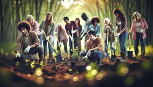
Moreover, the rise of citizen science and community engagement is facilitating broader access to remote sensing technologies. Initiatives that empower local communities to utilize remote sensing tools allow for enhanced ecological monitoring. This grassroots approach not only enriches conservation strategies but also fosters stewardship among individuals, linking them more closely to their local environments. Platforms that promote sharing of remotely sensed data can enhance collaboration among researchers, practitioners, and the public, democratizing data access and encouraging responsive ecological management.
As we look ahead, the synergy between drones and satellite imagery will redefine how we observe and interpret ecological phenomena. Drones equipped with specialized sensors can capture high-resolution images of specific areas, allowing for detailed assessments of biodiversity and ecosystem health. When combined with satellite data, this localized information can provide comprehensive ecological insights, enhancing predictive models that forecast climate change impacts and biodiversity shifts. In essence, the future of remote sensing holds the promise of a more nuanced understanding of our planet, enabling us to forge sustainable paths that benefit both biodiversity and human well-being.
In summary, investing in education around these technologies, embracing AI and collaborative methodologies, and leveraging drone-satellite partnerships will empower global communities to become proactive custodians of nature, ensuring a healthier ecosystem for generations to come.
Case Studies: Success Stories in Remote Sensing
Remote sensing has proven to be a game-changer in ecological research and conservation efforts, illuminating paths toward sustainable management of our planet’s natural resources. One compelling example is the use of satellite imagery in monitoring the Amazon Rainforest. By analyzing data from the Landsat satellites, researchers successfully identified deforestation patterns over several decades, leading to timely interventions by environmental agencies. This ongoing analysis not only tracks illegal logging activities but also helps policymakers develop strategies to preserve biodiversity within this critical ecosystem. The power of remote sensing here hinges on its ability to provide near-real-time data across vast and often inaccessible areas, enabling prompt action against environmental degradation.
Another success story unfolds in the Arctic, where researchers employed remote sensing technology to study the effects of climate change on polar ice caps. By utilizing high-resolution satellite images, scientists could assess changes in ice thickness and extent, revealing alarming trends that foretell global sea-level rise. The insights garnered have prompted international discussions on climate policy, highlighting the urgency to mitigate these impacts. This kind of data-driven advocacy underscores how remote sensing can fuel both scientific understanding and public awareness, urging collective action against climate change.
The integration of drones in conservation efforts exemplifies the innovative applications of remote sensing technology in ecology. A notable initiative in East Africa, for instance, utilized drone surveys to monitor wildlife populations in real time. Equipped with thermal imaging, drones can spot animals in dense vegetation, significantly improving wildlife management and anti-poaching measures. This method not only enhances data accuracy but also reduces the stress on animals, as traditional surveying techniques often involve human interference. By bridging the gap between technology and on-the-ground conservation, drone-supported remote sensing demonstrates how innovative approaches can lead to tangible benefits for both ecosystems and the species that inhabit them.
In summary, case studies like these illustrate the transformative impact of remote sensing in ecology. They showcase how technology can empower local and global communities to make informed, sustainable decisions. As we witness these success stories, it is clear that embracing remote sensing technologies can lead us toward a more resilient and thriving planet. Whether it is through rigorous monitoring of deforestation, tracking climate change, or advancing wildlife conservation efforts, the future of ecological stewardship lies in the skies above us.
Comparing Remote Sensing Techniques: Satellites vs. Drones
The burgeoning field of remote sensing is reshaping our understanding of ecology, largely thanks to two standout technologies: satellites and drones. While both serve the vital purpose of collecting data from above, their applications, advantages, and limitations differ significantly, offering researchers and conservationists tailored tools for various ecological challenges.
Satellites orbiting the Earth provide extensive, global coverage, capturing vast landscapes in a single sweep. Equipped with sophisticated sensors, they can monitor large-scale environmental changes such as deforestation, urban sprawl, and climate-related phenomena like droughts and floods. For example, NASA’s Landsat program has been pivotal in tracking long-term changes in land use and surface temperatures, allowing researchers to identify trends over decades. Satellite imagery is invaluable for assessing broad patterns, making it essential for large-scale environmental monitoring and policy-making.
On the other hand, drones bring a level of detail and agility that satellites cannot match. Operating at lower altitudes, drones capture high-resolution images and data, allowing for close-up examinations of specific areas. This is particularly beneficial for wildlife monitoring or habitat assessments, where understanding microhabitats or animal behaviors is crucial. Drones can cover areas that are challenging for traditional field surveys, such as dense forests or rugged terrain, and provide real-time data, significantly enhancing wildlife conservation efforts. For instance, conservationists in East Africa have successfully used drone technology to monitor endangered species and track potential poaching activities, demonstrating how these nimble devices can enhance both data accuracy and operational efficiency.
- Scalability: Satellites excel at covering vast areas, making them ideal for regional to global assessments.
- Detail: Drones offer finer resolution images which are useful for focused studies and specific site investigations.
- Cost: Drones can be more affordable for ecological studies, allowing smaller organizations to access high-quality data.
- Accessibility: While satellites can provide data over hard-to-reach locations, drones can fly below cloud cover and capture data in real time.
Regardless of the method chosen, both satellites and drones play integral roles in ecological research and conservation. By understanding their respective strengths and applications, researchers can employ a more integrated approach to ecological monitoring, ensuring that data-driven decisions protect our planet’s biodiversity effectively. Embracing these advanced technologies not only aids in fulfilling scientific objectives but also empowers communities to engage in sustainable practices, fostering a collaborative approach to environmental stewardship.
Getting Started with Remote Sensing: Tools and Resources
In a world increasingly shaped by environmental challenges, remote sensing offers a powerful lens through which we can observe and interpret natural phenomena. For anyone looking to delve into this dynamic field, understanding the available tools and resources is crucial. Whether you are a researcher, conservationist, or an eco-conscious individual, there are numerous ways to leverage remote sensing technology to enhance your ecological insights.
One of the most accessible ways to get started is through online platforms that provide satellite imagery and data. Websites like NASA’s Earthdata, Google Earth Engine, and Sentinel Hub offer free access to an abundance of remote sensing data. These platforms allow users to analyze changes in land use, monitor deforestation, or track water quality over time. Many also include tutorials and user-friendly interfaces that make it easier to visualize and interpret the data, regardless of your technical skill level.
Additionally, for those interested in more hands-on applications, numerous drone technologies have become widely available and affordable in recent years. Companies such as DJI offer consumer drones equipped with high-resolution cameras and sensors that can capture detailed ecological data. Many community colleges and universities also offer courses and certifications in drone operation and remote sensing techniques, providing a solid foundation in practical applications.
Here are some essential resources to consider as you embark on your remote sensing journey:
- Online Courses: Platforms like Coursera and edX offer courses focused on remote sensing and GIS (Geographic Information Systems), often taught by leading universities.
- Software Tools: Familiarize yourself with software such as QGIS, ENVI, or ERDAS IMAGINE, which are frequently used in remote sensing data analysis.
- Research Publications: Journals such as *Remote Sensing in Ecology and Conservation* provide valuable studies that demonstrate innovative applications of remote sensing technology[[1]](https://www.zsl.org/about-zsl/organisation/zsl-publications/remote-sensing-ecology-and-conservation).
- Community Forums: Participate in forums such as GIS Stack Exchange or the “Remote Sensing” group on LinkedIn, where many practitioners share tips, resources, and experiences.
By harnessing these tools and resources, you can play a vital role in ecological stewardship, effectively utilizing remote sensing technology to monitor our planet’s health and promote sustainable practices. Embracing this technology is not just about data collection; it’s about fostering a deeper connection to the environment and contributing to the collective effort to uphold biodiversity for future generations.
Frequently Asked Questions
Q: What is the role of remote sensing in understanding biodiversity?
A: Remote sensing plays a crucial role in monitoring biodiversity by providing data on ecosystems, animal habitats, and plant distributions. It allows researchers to track changes over time, helping identify areas of conservation priority and assess ecosystem health effectively.
Q: How does remote sensing contribute to habitat loss prevention?
A: Remote sensing aids in habitat loss prevention by identifying land use changes and environmental degradation. By monitoring ecosystems from above, scientists can detect deforestation or urbanization trends early and implement conservation strategies to protect vulnerable habitats.
Q: What technologies are used in ecological remote sensing?
A: Ecological remote sensing employs various technologies, including satellites, drones, and aerial imagery. These technologies help collect data on vegetation indices, soil properties, and water quality, providing insights into ecological dynamics and changes in our environment.
Q: Why is remote sensing important for studying climate change effects on ecosystems?
A: Remote sensing is vital for studying climate change effects because it allows continuous monitoring of ecological variables across large areas. This technology helps track shifts in species distribution, vegetation phenology, and habitat conditions related to climate variations.
Q: How accurate are remote sensing methods in ecological research?
A: The accuracy of remote sensing methods varies based on the technology used and the ecological parameters being measured. Advanced sensors and algorithms can enhance accuracy, but integrating ground-truthing and field data is crucial for validating remote measurements.
Q: What are the key challenges in using remote sensing for ecological studies?
A: Key challenges include data interpretation complexities, the need for high-resolution imagery, and atmospheric interference. Additionally, varying ecological responses to environmental changes can complicate the analysis, requiring multidisciplinary approaches for effective insights.
Q: How can beginners get started with remote sensing for ecology?
A: Beginners interested in remote sensing for ecology can start by familiarizing themselves with basic concepts and technologies. Online resources, courses, and software tools like Google Earth Engine can provide hands-on experience in analyzing remote sensing data for ecological applications.
Q: What future trends are emerging in remote sensing for ecological research?
A: Emerging trends in remote sensing for ecology include the use of artificial intelligence for data analysis, improved sensor technologies, and greater integration with ground-based observations. These advancements will enhance the monitoring of ecosystems and contribute to better conservation practices.
To Conclude
As we conclude our exploration of remote sensing in ecology, it’s clear that these innovative technologies are vital for understanding and preserving our natural world. By harnessing data from above, we can monitor biodiversity, track climate change impacts, and inform conservation efforts-all essential for a sustainable future. Now is the perfect time to dive deeper into this fascinating field. Explore related articles on how remote sensing informs land conservation strategies or discover practical ways to reduce your ecological footprint through sustainable living practices.
If you enjoyed this content, don’t miss out-subscribe to our newsletter for the latest insights on environmental science, and join our community of eco-conscious individuals. Your commitment to understanding these technologies propels the movement toward a greener planet. Share your thoughts in the comments below! Together, we can make a real impact on our ecosystems. For more resources and tools, check out our guides on green technologies and biodiversity conservation. Every small action contributes to greater change!